Map View Design Mode
In Pathfinder the location is the top level of the nested hierarchy.
Buildings created from infrastructures on the map consist of the 3D model and a label. The labels display the names given in the building properties.
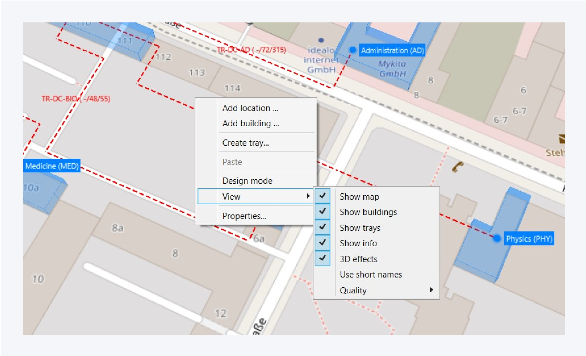
View Options
Press F12 to enable Design mode. You can also access the design mode from the bottom right corner of the map as well as from the context menu. In design mode on the location view, you can move your building marks to new positions. You can also add nodes to your trays and create specific path ways.
You can change the information displayed on the map from view in the context menu.
Here you can enable and disable certain visuals and effects the map area.
You can assign a custom background for your location or disable custom background by changing the view mode. To view your building’s location on the map as well as on a custom background, select “Both“.
Joining Footprints
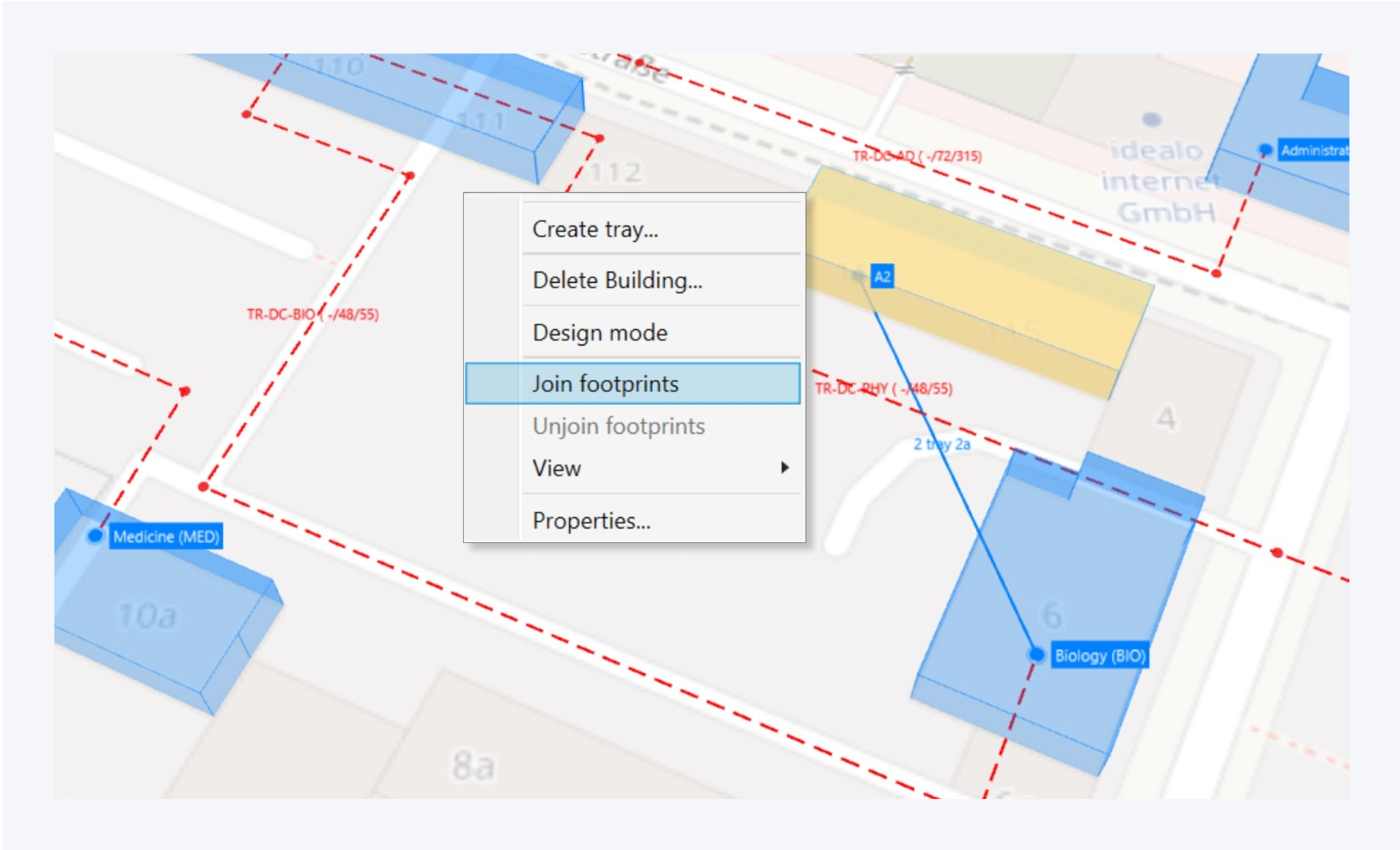
You can select a label and a building model to join footprints. You can also unjoin existing footprints. It is also possible to select multiple building models using Ctrl and assign them to the same building.
Select two building labels and click create tray in the context menu to place a tray between the two buildings.
You can manage the location properties from the context menu here as well.
Double click on a label to enter the building and view the floors.
Layout Options
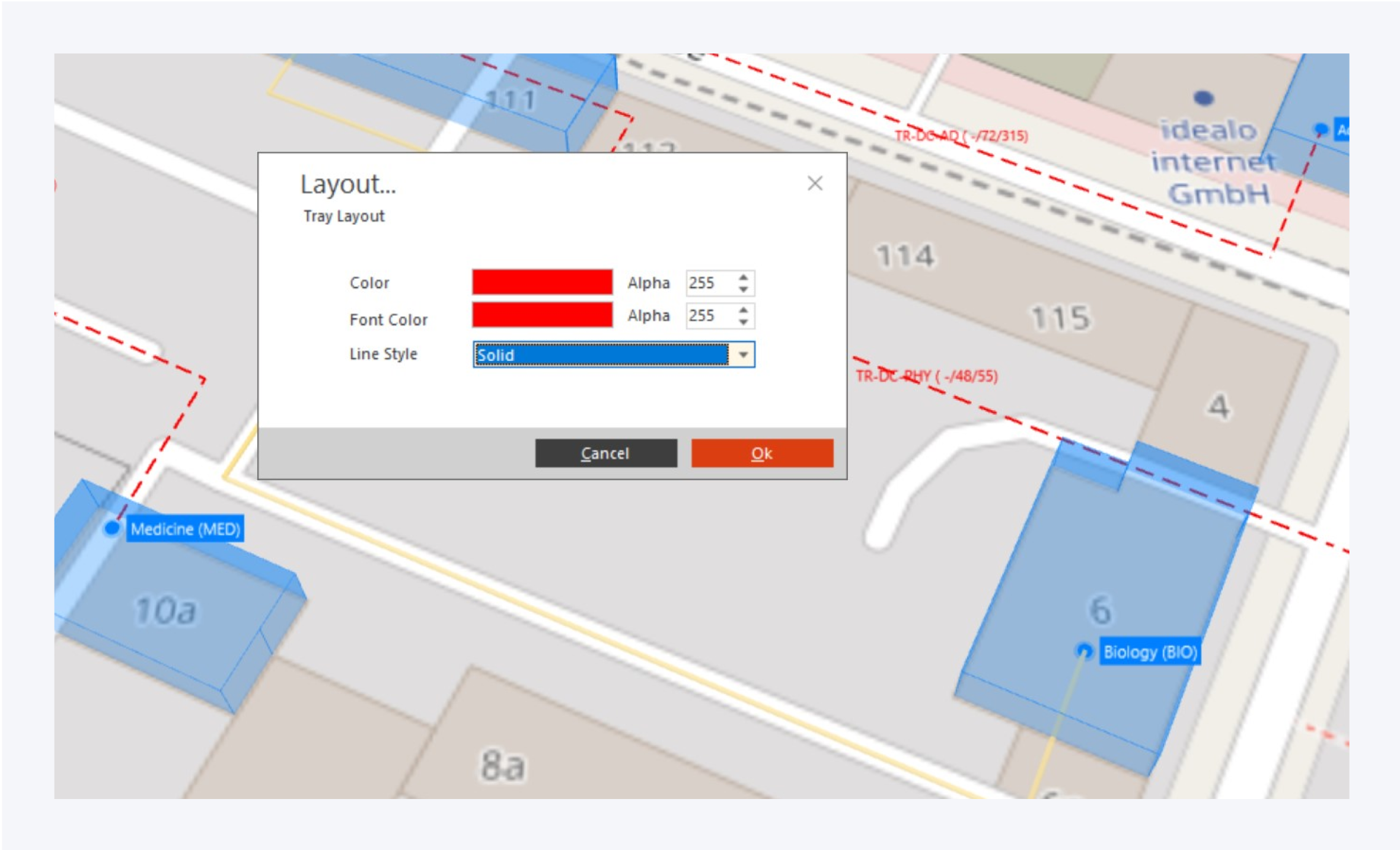
In the map view, you can customize the tray visuals. Right click on a tray and select Layout from the context menu to customize the tray.
You can assign a specific color, font color and line style to the tray.
Click on OK to confirm your changes.